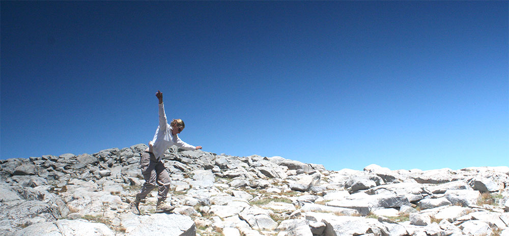
This past Wednesday was the official 10-year anniversary of the finish of my thru-hike of the Pacific Crest Trail (PCT) It’s honestly something that I still think of on a daily basis and is truly one of the top highlights of my life. Shortly after the finishing the trail, I started to write down what I thought were the best sections of the trail. I’ve updated, and added to my thoughts over the years, and I’ve compiled it all together in what I believe are the top five sections of the trail.
The sections below offer nearly constant amazing scenery and blissful hiking:
Klamath Mountains
Dunsmuir to Ashland

Towards the Northern end of California, the Pacific Crest Trail (PCT) takes a sweeping detour towards the Pacific Ocean. Instead of following the Cascades northward, the trail dips into to the Sacramento River Valley and comes up on the other side, into a beautifully rugged and forgotten corner of the west. This stretch of trail has some beautiful and lonely country, as well as three of the most interesting, quaint, and vibrant trail towns of the entire trail.
This is an overshadowed stretch of trail. Many PCTers are just eager to cross that Oregon state line and leave the very long state of California behind. However, this truly is some of the best scenery on the PCT, and time should be taken to truly enjoy it. This stretch of trail stands out in my mind as one of the surprises of the trail. It’s sometimes difficult to gauge the beauty of an area based on a map, especially with so many scenic areas and landscapes that one will experience while walking such a vast distance. This section of trail far surpassed my limited knowledge of the area and became my 5th favorite section of trail.
Dunsmuir
Dunsmuir is a small, but stylish town. It is actually a few miles north of the PCT, but makes for a great stop for long distance hikers or a great beginning for those looking to complete this section of trail. Old buildings, a dense and very walkable town center, as well as a surprisingly large and varied array of foods make Dunsmuir a favorite for PCT hikers. Be sure to check out the Cornerstone Bakery & Cafe for a great breakfast, and Sengthong’s for better Asian food than you should have access to in a town of this size.
Castle Crags
Just outside of Dunsmuir, lies Castle Crags State Park, an impressive mountain of granite spires rising out of the pine forest which makes the climb out of the Sacramento River Valley much more manageable. The Castle Crags are a great introduction to the mountains of northern California.
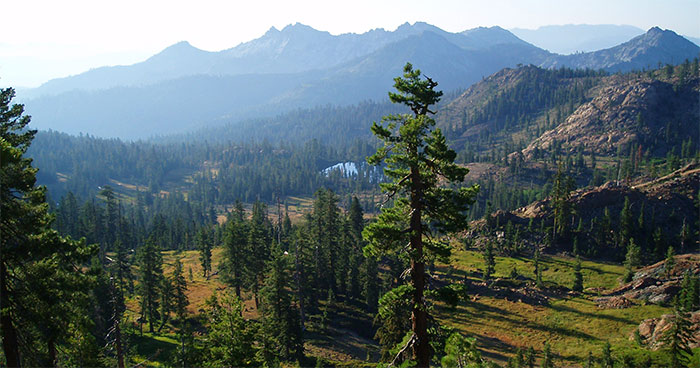
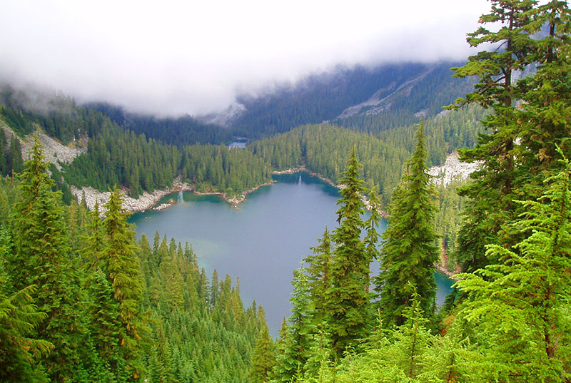
Russian Wilderness
The Russian Wilderness is an outstanding area of the Klamath Mountains. Large, sculptural granite rock formations, deep blue lakes and vistas stretching through deep valleys and ridges as for as the eye can see. The PCT makes a quick pass through the Russian Wilderness, but the area deserves much more attention and exploration.
Etna
Etna is for many PCT thru-hikers, the best town on the trail (it does require a substantial hitch-hike from the trailhead). The quaint town has a charm largely derived from its history and seclusion. It truly feels like stepping back half-a-century, when small towns were dominated by small locally owned shops and community members took pride in their town and supported their own. The town offers an old-fashioned soda fountain, several nice bed and breakfasts and great eateries, including the Etna Brewery.
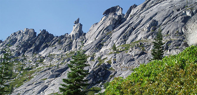
Marble Mountains
The Marble Mountains offer the best mountain scenery along this stretch of the Pacific Crest Trail (not that any of this section is really lacking with great mountain scenery). The bright white peaks of these marble and limestone mountains, with meadows and lakes makes for great hiking and exploration.
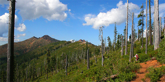
Red Buttes
The mountains of this section of trail vary greatly. Having passed through the granite spires of the Castle Crags, the almost unnaturally white mountains of the Marble Mountains, the mountains make another change into a very rich red color. Coming tantalizingly close to the Oregon Border, the PCT climbs out of the Seiad Valley to walk along the crest of these mountains, before eventually crossing into Oregon.
Ashland
Rounding out this section’s great towns is Ashland. Many know it for its Shakespeare and strong Theatre presence, and if timed correctly, PCT hikers can enjoy a bit of culture while on break from trail life. Ashland is a long hitch-hike from the trail, but worth it to experience the nice, vibrant downtown and cultural amenities.
There is much to do along this stretch of trail, and a slow-paced section hike would be the perfect way to experience the beautiful scenery and wonderful towns that characterize this section.
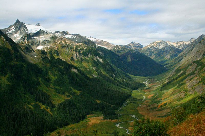
South Washington Cascades
Mt. Adams to Mt. Rainier

Pacific Crest Trail hikers strive for the state of Washington. It was the crossing over the Bridge of the Gods which spans the Columbia River and connects Oregon and Washington where I first began to feel that our trip was in its final days, along with the feelings of excitement and sadness that the impending end of such a trip produces. The trail north of the Columbia is mostly rolling forested hills with limited views, which gives plenty of time to contemplate the nearness of the end – but the trail is far from done. After a few days of thoughts of the end, the scenery soon becomes spectacular and pulls you back into some of the best scenery of the trip.
Some of the largest volcanic peaks in the northwest frame this section of trail, passing by the very impressive peaks and mountains of the southern Washington Cascades, including Mt. Adams (12,276′), through the Goat Rocks Wilderness, and past Mt. Rainier (14,410′).
Mt. Adams
Beginning at Forest Service Road 23, the Pacific Crest Trail climbs up the western flanks of Mt. Adams, and joins the Round the Mountain Trail. The trail works its way around to the northern flanks of the peak, over rushing torrents filled with fresh glacier runoff, through wildflower filled meadows and great views of the massive Adams Glacier that is slowly cutting the peak in half. Before leaving Mt. Adams, the Pacific Crest Trail passes through the meadows around Killen Creek, a beautiful farewell to Mt. Adams as the trail speeds to the north and the mountain recedes.
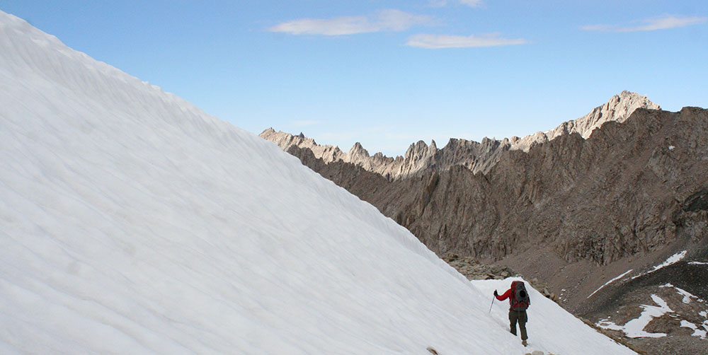
Goat Rocks
After a brief break in alpine mountain scenery past Mt. Adams, the Pacific Crest Trail quickly sets out to impress once again, as it enters the Goat Rocks Wilderness. The rugged peaks of the Goat Rocks, the remains of what once was a 12,000′ volcano, provide for an incredible backdrop for beautiful alpine country. After crossing above the Packwood Glacier, the Pacific Crest Trail sticks to a narrow spine of rock as the mountains recede on either side to deep valleys and meadows – one of the most spectacular stretches of the Pacific Crest Trail. For those looking to experience the Goat Rocks without hiking the PCT, numerous great loop trips sample this wilderness area.
William O Douglas Wilderness
Beyond US Highway 12, the Pacific Crest Trail climbs into the William O Douglas Wilderness. While not as spectacular as the other highlights of this section, the land is dotted with numerous beautiful lakes and plenty of territory ripe for exploration. Towards the northern end of the wilderness, the landscape turns more rugged as the trail flirts with the Mt. Rainier National Park Border.
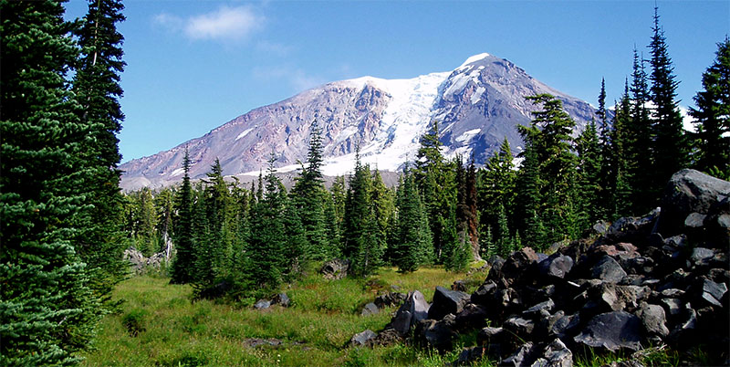
Mt. Rainier
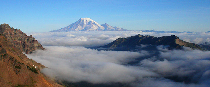
The queen of the Cascades, Mt. Rainier first enters the vision of thru-hikers in Oregon, where it rises along the horizon and grows for weeks as hikers speed north. The trail actually only barely dips into the National Park, but because of the enormity of this mountain, perhaps its for the best. Any closer, and and you wouldn’t be able to fully take it all in. Highway 410 makes for a good end point for this spectacular section, but some of the best views arrive just past the highway as the trail climbs past Sheep Lake and makes its way up to Sourdough Gap. Because of this, Crystal Mountain would make for an ideal end point for those looking to hike this section.
Central Oregon Cascades
Highway 58 to Olallie Lake

Being from Portland, we have experienced quite a bit of the central Oregon Cascades – random hikes and backpacks around Mt. Jefferson and the Three Sisters. Of course I knew that they were all part of the same mountain range, but the connections and how they relate to one another was lost on our singular trips. The Pacific Crest Trail (PCT) offered an opportunity to experience these separate areas as one larger and continuous series of mountains, with beautiful areas in between, fostering a new-found appreciation for our local mountain range.
The string of mountains that pulled us north through central Oregon, along with their glaciers (which we hadn’t seen too much before this point in the trip), meadows, and lakes ranked as my third most scenic section of the PCT.
It was a little difficult on finding the beginning point for this section. There are a lot of great areas of the PCT in Oregon, all relatively close to each other; the Sky Lakes Wilderness, Crater Lake, Mt. Thielson, Diamond Peak, etc, but there is some less spectacular country between these high points so it’s not constantly spectacular. For me, the beginning of the high point of the Oregon section began at Elk Lake, just south of the Three Sisters.
The Three Sisters
The scenery quickly becomes spectacular from Elk Lake (where a nice resort with a restaurant exists), and which makes for a good beginning point for those looking to hike this section, as the trail rises to the crest of the Cascades, views of Mt. Bachelor, Broken Top and the South sister begin to dominate the view.
The trail stays alpine as it travels alongside each of the Three Sisters, with great views of the Mountains, frequently crossing clear streams, ponds, and meadows. Towards the northern end of the Wilderness, the landscape turns alien, as it crosses through Collier Cone’s lava flow (the side trip up to the top of Collier Cone is a great diversion).
The Sisters begin to recede as the trail travels north, through lava flows and passing the quiet Matthieu Lakes, with views of the Sisters to the south. The Three Sisters Wilderness ends at highway 242, which many hikers take to resupply in Sisters and is considered by many to be one of the top trail towns along the PCT.
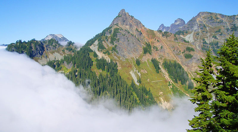
Mt. Washington Wilderness
The Mt. Washington Wilderness is a highly volcanic area. Its lava flows look like they oozed out of the Earth yesterday and provides the most striking volcanic landscape of the entire PCT. The hike up to Belknap Crater is stunning – a barren landscape of chunky lava – a landscape of odd sculptures.
The trail then quickly arrives at the foot of Mt. Washington. While a small peak, there were some unexpectedly beautiful areas on the western flanks of the peak, with nice meadows and views to the sharp summit of the mountain.
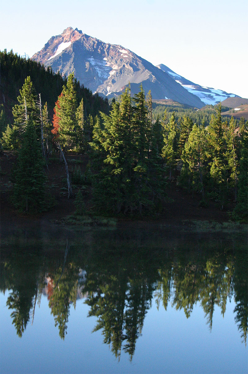
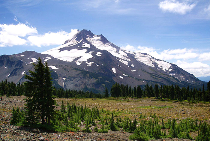
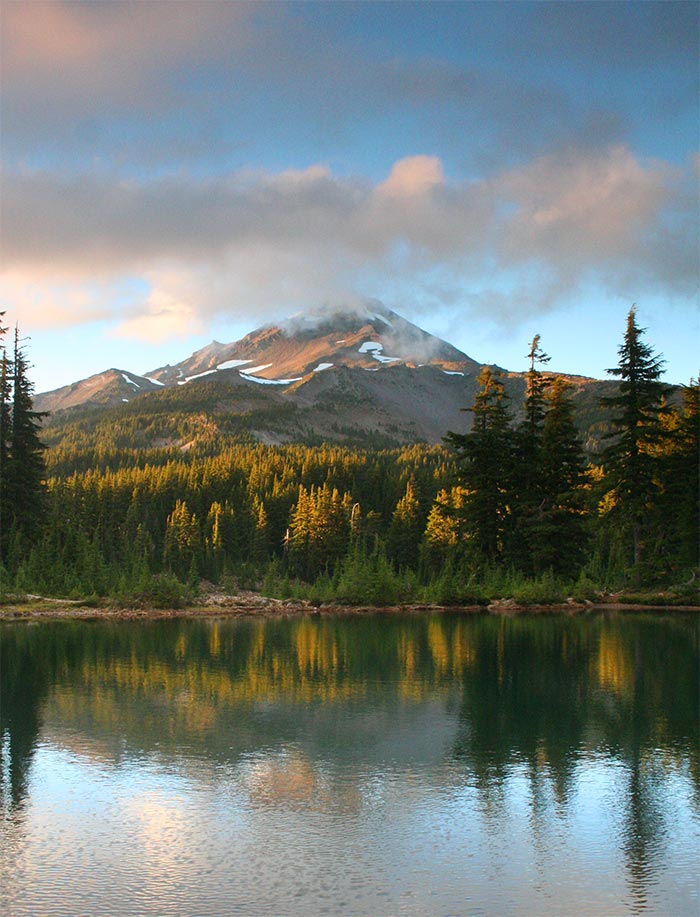
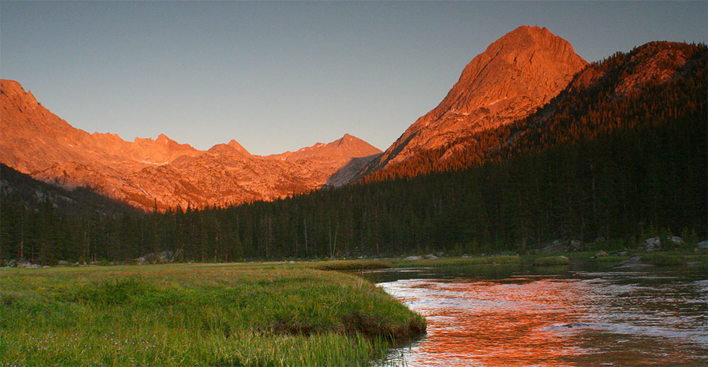
Mt. Jefferson Wilderness
The PCT works its way to the northern flanks of Mt. Jefferson, reaching the spectacular Jefferson Park, an incredibly flat meadow, dotted with lakes and the glaciated peak of Mt. Jefferson rising sharply from it’s southern edge.
The trail crosses Jefferson Park Ridge before slowly dropping to breitenbush Lake, and the end of this spectacular section.
The PCT rises along the flanks of Three Fingered Jack, which, along it’s western side, rises like a smooth wall from the trail. The PCT works its way to the northern ridge of the mountain and descends towards Minto Pass, where several nice lakes dot the landscape (this area was unfortunately scarred from a recent forest fire). The trail then rises to above 6,000 feet, offering great views of the surrounding landscape and the approaching Mt. Jefferson.
The PCT works its way to the northern flanks of Mt. Jefferson, reaching the spectacular Jefferson Park, an incredibly flat meadow, dotted with lakes and the glaciated peak of Mt. Jefferson rising sharply from it’s southern edge.
The trail crosses Jefferson Park Ridge before slowly dropping to breitenbush Lake, and the end of this spectacular section.
The singular peaks of the Oregon successfully pulled us ever-northward, and in comparison with some of the other sections which would rise and fall by thousands of feet daily, the Oregon section stayed fairly level. Because of the beautiful and dynamic scenery, as well as the wonderfully easy hiking conditions, the Central Oregon Cascades stand out as a great stretch of trail that would be perfect for those looking to experience a piece of the PCT.
Northern Cascades
Snoqualmie Pass to Canada

The Northern Washington Cascades are a fitting conclusion to the Pacific Crest Trail (at least for those who start in the south) with some of the most rugged and beautiful landscapes of the entire route; deep canyons, jagged mountain peaks, dense forests, and enormous glaciers. All of this makes the section of trail between I-90 and the Canadian border, the second-best stretch of the entire trail.
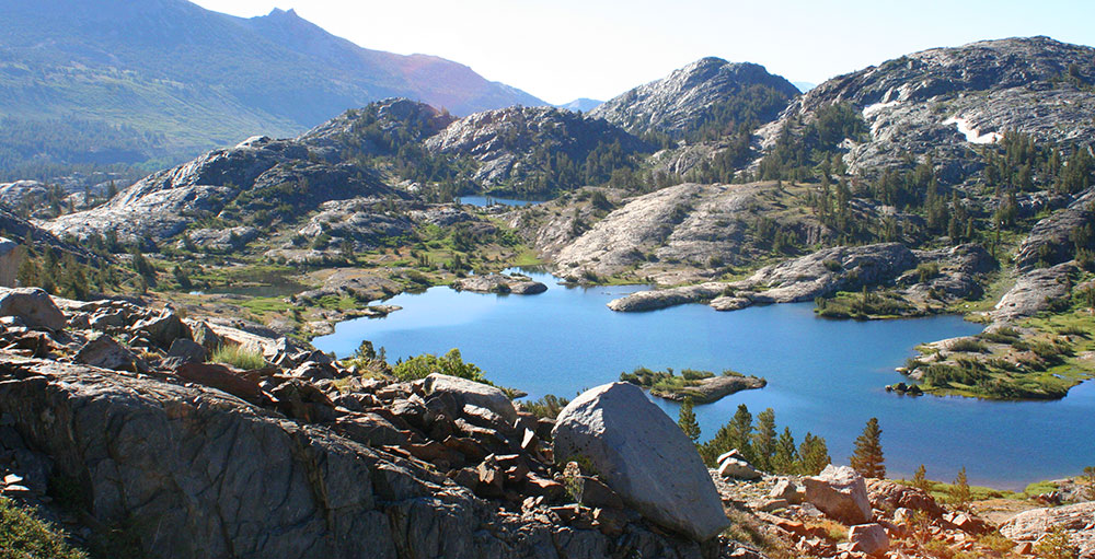
Alpine Lakes Wilderness
The trail climbs from the interstate and into the vast wilderness of the Alpine Lakes. Once up, the scenery is great as it passes above beautiful lakes that rest in hanging valleys below the ridge. Large mountains, cliffs, and glaciers force the trail to more reasonable routes through the lush lowlands and up and over a series of ridges.
Unfortunately, we encountered rain for much of our hike through the Alpine Lakes — another aspect that one has to accept when hiking through the Cascades of Washington in the fall. We missed some good views I’m sure, but we still enjoyed the tranquil Glacier, Surprise, and Trap, Josephine Lakes on our way to Stevens Pass.
Glacier Peak Wilderness
Due to some pretty nasty trail conditions during our 2007 trip, we detoured to the east side of Glacier Peak, experiencing the Napeequa Valley and Little Giant Pass instead of the real route which stays on the western flanks of Glacier Peak. We were mildly disappointed not to stay on the actual Pacific Crest Trail, but the great thing about the North Cascades is that it’s all spectacular — you really can’t go wrong. Our detour was incredibly beautiful, and we experienced areas that I’m sure were much wilder and remote than the usual route. Everyone should experience Little Giant Pass at some point in their hiking careers.
Stehekin
Stehekin, the last bit of civilization before reaching Canada, lies at the end of Lake Chelan. It’s a bit off trail, but thanks to a National Park Service shuttle, it’s a super easy side trip. There isn’t much to Stehekin, but there is a good place to stay, nice views of the lake and mountains, and most importantly, a fantastic bakery. We ate a lot of baked goods during our time off, and loaded up our packs with carbs for the final couple of days on the trail.
The trail beyond Stehekin stays fairly mellow until reaching Highway 20, staying low in the valleys while following the Stehekin River and Bridge Creek, so you can ease back into things after consuming too many cinnamon rolls.
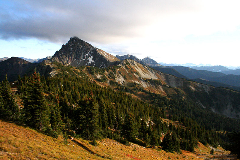
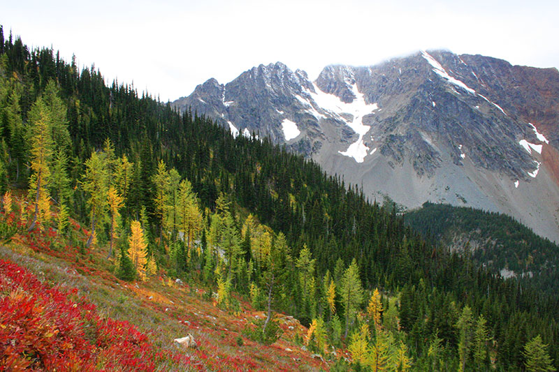
Pasayten
As we reached our final few days on the trail, there was a chill in the air and the sense of the coming fall. We reached the Pasayten wilderness — a series of rocky ridges, peaks, and valleys where my lasting impressions are of gold. The green meadows that we had experienced for much of the hike had started their turn from green to to shades of yellow, brown, and red. The larch trees that dot the Pasayten had turned a bright yellow, contrasting sharply against a fresh dusting of snow on the surrounding peaks and the looming gray skies.
It’s a drier mountain landscape, as compared with the rest of the North Cascades. The starkness and rapidly approaching end of the trail left, at least me, in a more somber and contemplative mood than I had experienced on the rest of the trail.
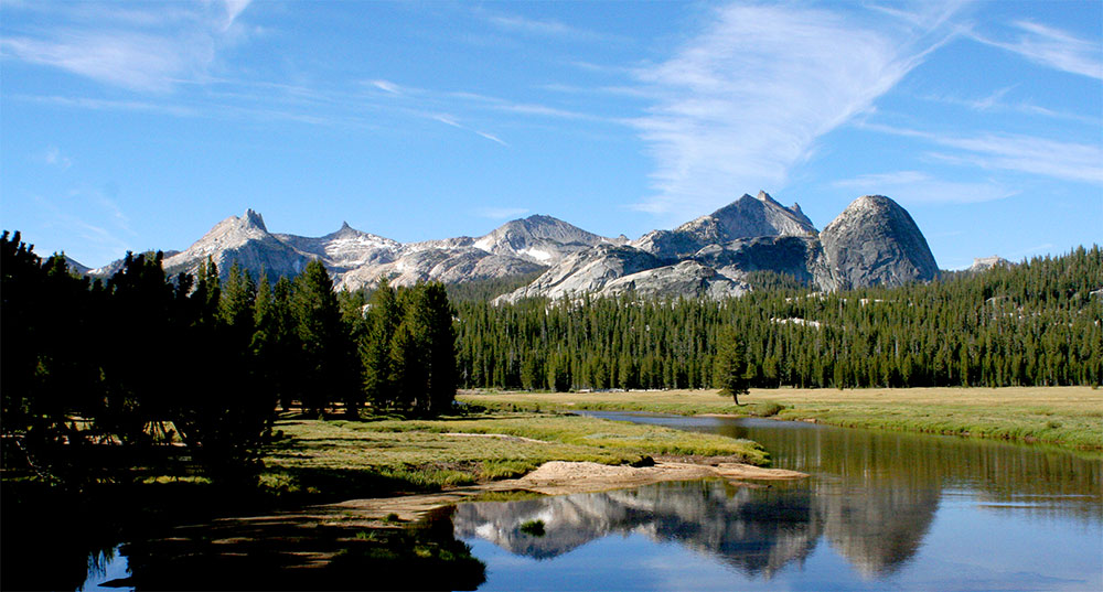
The Sierras
Kennedy Meadows to Donner Pass

Anyone moderately familiar with the Pacific Crest Trail (PCT) could have predicted what I, and many others, believe to be the best stretch of the Pacific Crest Trail — The Sierra Mountains. This is a land of shaved granite, green meadows, sharp peaks, high passes, and deep valleys.
It is a welcomed section of trail. After a month-and-a-half of walking through the dry and hot desert of Southern California, it’s refreshing to hit this first major scenery change. Sure, there are a few good mountain sections in southern California, like the San Bernadinos and Mt. San Juacinto, but the Sierras feel very different.
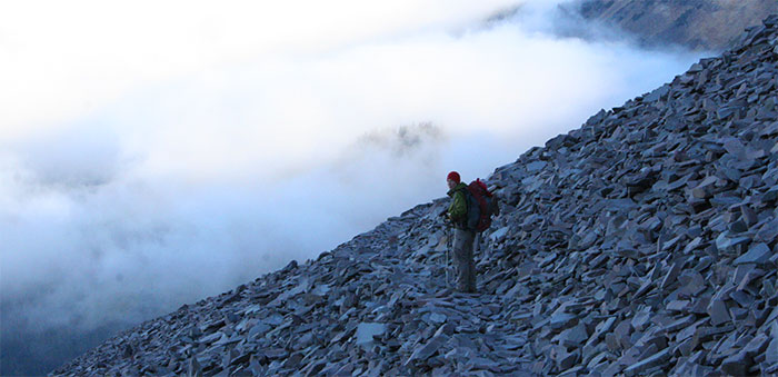
The Sierras also offer some of the most challenging hiking of the entire trail. We were lucky to hike the Sierras during a low snow year, but for those less fortunate, the high passes can be snowbound, necessitating the use of ice axes and slowing progress to a crawl. In these snowier years with more snowmelt, creek fords can become deep, swift, and potentially dangerous.
Sequoia and Kings Canyon National Park
The Sierra Nevadas rise abruptly after the trail leaves from Kennedy Meadows, which is the last on-trail resupply point before the trail enters the the land of craggy granite peaks and high passes.
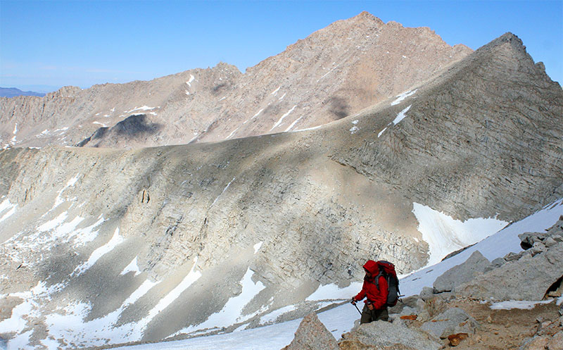
The highest point on the PCT, Forester Pass, which rises just arrives just after passing by the highest point in the lower 48, Mt. Whitney, a worthy side trip. Some of the best scenery of the entire PCT is contained in these two national parks, where the Sierras are at their highest.
There are so many more highlights within these parks — Rae Lakes is absolutely stunning, the starkness of Pinchot Pass, Palisades Lakes, the beautiful walk down Palisade Creek, the otherworldliness of the high altitude landscape around Helen and Wanda Lakes. The beautiful Evolution Valley. It’s all stunning.
John Muir Wilderness and Mammoth Lakes
While the scenery isn’t nearly as stunning as that of Sequoia and Kings Canyon, the Sierras north of Kings Canyon National park is still incredibly rugged and scenic, with numerous lakes to enjoy. One of the most memorable and enjoyable nights on the trail for me was just spent wandering the shores of Lake Virginia as we waited for the sun to drop behind our camp. The next day we would drop down from the ridge to catch a bus into Mammoth Lakes, a fun mountain town worthy of a multi-day break.
Minarets Wilderness
Just after Mammoth Lakes, the scenery picks right back up as you enter the Minarets Wilderness. Banner Peak, the dynamic centerpiece of the wilderness hangs high above numerous lakes, the most famous of which is Thousand Island Lake.
Yosemite
Yosemite is one of the busiest national parks in the entire US, but since the PCT stays out of the insanely popular valley, where most of the waterfalls are found, the trail feels relatively secluded. Hiking the PCT through Yosemite is less about dynamic and craggy mountains, and more about nicely rounded granite peaks, green meadows, lakes, and plenty of glacially shaved granite.
The busiest stretch piece of trail is at Tuolumne Meadows, where the trail crosses Highway 120. The people quickly fade away as the trail continues north of the Highway, and into the lonely backcountry where granite peaks and green meadows are common.
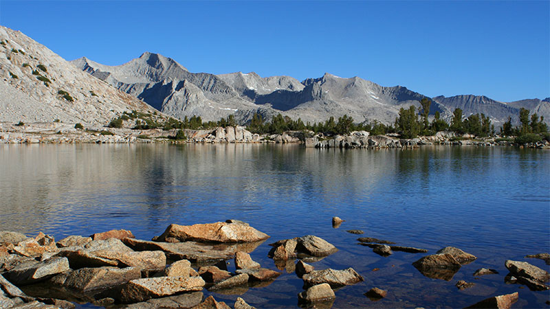
Desolation Wilderness
North of Yosemite, the mountains aren’t quite as impressive, but there are still plenty of nice mountain lakes, meadows, and peaks. Near lake Tahoe, the PCT reaches the Desolation Wilderness, with numerous lakes and the beautiful granite that is reminiscent of the Sierras further south.
While this list is comprised of my list of the best sections of trail, there are of course spectacular areas not contained within these well defined boundaries. Places like Crater Lake, Mt. Hood, and the mountains of Southern California all offer great scenery, along with countless places in between. The Pacific Crest Trail is a spectacular trail, and I’m fortunate to have had the opportunity to experience it.