A Solo Backpack
Jeannie spent the past few days showing off little Mason to our friends and family in Portland, which gave me the opportunity to get out on another adventure.
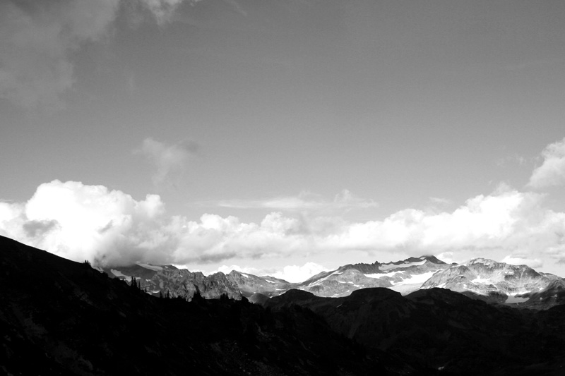
For this trip, I headed up to the Glacier Peak Wilderness where I created a loop trip connecting Lost Creek Ridge over to Lake Byrne, south along the Pacific Crest Trail, and out the North Fork Sauk River. I got to relive some memories of the Pacific Crest Trail with some thru hikers that were doing a stretch south-bound, and with whom I got to hike with for seven or eight miles. It was a trip that was beautiful, brutal, and downright painful at times — but that’s why I love backpacking. I love the scenery and the adventure, the work involved, the sore muscles, and even the pain. I’m sore as I write this. I miss this.
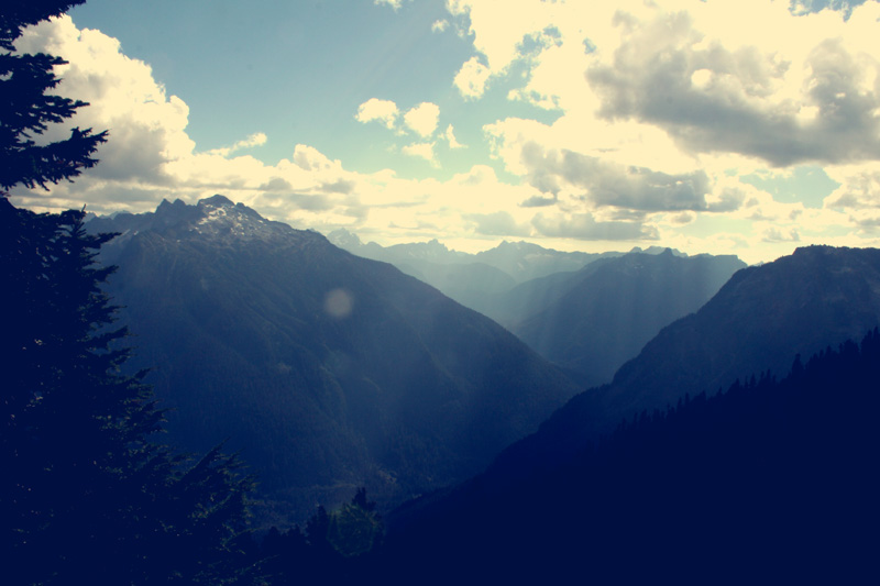
The first step was climbing up from the valley bottom — actually, there was a 3.5 mile gap between my beginning and ending trailheads, so I dropped off my bag at one trailhead drove the car to the other trailhead, and ran the 3.5 miles back to the first trailhead to begin my hike. The real hike started with a pretty brutal ascent up the ridge — around 3,600′ elevation gain in about three miles.
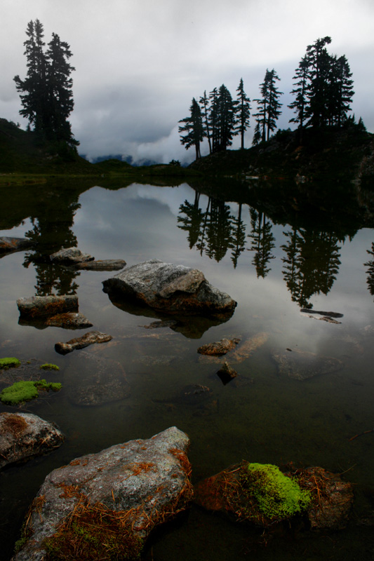
I camped on the far shore of Hardtack Lake. It was a nice, quiet lake. In the morning, the clouds were swirling about. I wasn’t sure if there was rain in my future, but a few holes in the clouds showed that the cloud deck wasn’t too deep, so I was guessing they would eventually burn off.
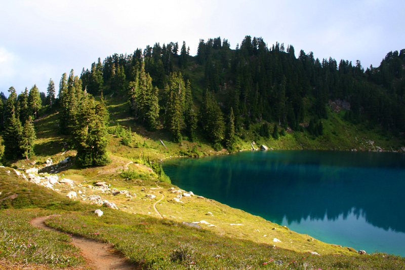
Camp Lake – about a mile beyond where I camped. My hike got off to a later start than I wanted (thanks Seattle traffic!), so I wasn’t able to make it to this lake the night before, or my real target, which was Byrne Lake.
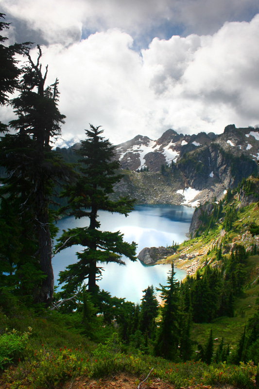
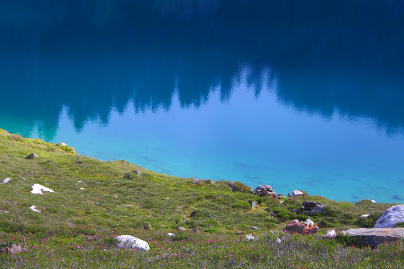 Camp Lake is a nearly fluorescent bluish-green in real life (not the greenish color that can be present in glacial lakes). It’s actually a color that’s quite common in mountain lakes like this, but it always seems new and unbelievable when you see it.
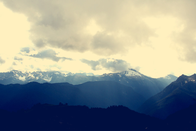
Lake Byrne was beautiful, especially with some dynamic clouds swirling about. I probably would have had some good views of Glacier Peak from around here, but the clouds obscured everything except the very bottoms of some impressive glaciers.
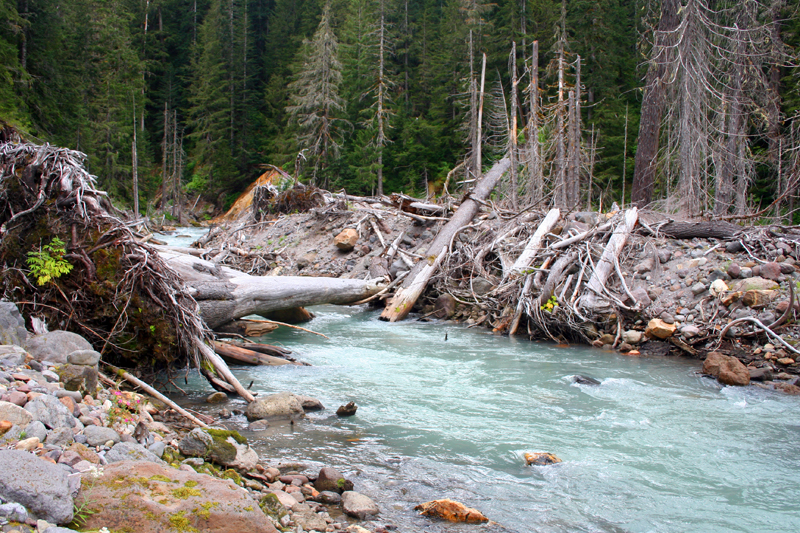
There used to be a bridge around here somewhere, but around 2003 there was flooding that did some major damage to the area. This washed out the bridge, and made the main route up to Lake Byrne a bit more difficult, so it isn’t travelled much these days. It is a steep route, dropping 2,500′ in about two miles. Because of the lack of foot traffic, it’s also fairly overgrown. My knee had also started hurting near the top of the descent (it was a little tweaked from our previous backpack), and by the bottom, it was sending sharp bolts of pain from my knee and down to my ankles whenever I had to bend it — which was like every step. I was hoping for an easy river crossing, but, while it doesn’t look too bad from this picture, the river was moving pretty swiftly, and it was probably waist to chest deep in places. Luckily there were a couple logs that could be used to cross, which is great as long as you don’t lose your balance and fall in. I didn’t.
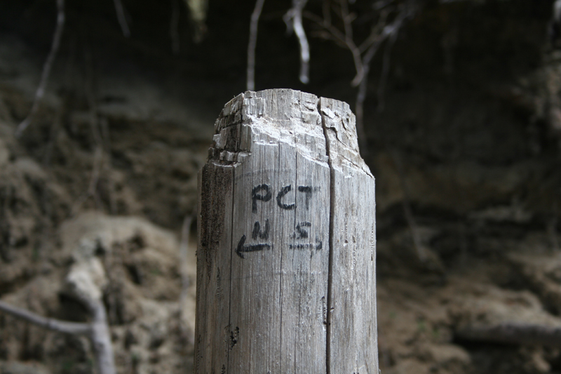
With the brutal descent down to the river crossing, brushy trail, and a knee that I wasn’t even sure I should be walking on, I finally made it to the Pacific Crest Trail. Oh PCT, how I love you. The whole way down the hill from Lake Byrne, I just had the PCT on my mind. A trail where ups and downs are gradual (my knee was hurting the most on steep downhill, but somewhat on uphills as well, so the gradual rises were a big help), and a nice tread. There were also people! I hadn’t seen any for the last 12 miles, so it was nice to know there were other people out there — and not just any people — PCT people!
As I was popping Ibuprofin and stretching out my knee, two hikers approached from the north. They were actually PCT hikers — Tasty and Storybook. We talked for a bit, and we were soon joined by Crawfish. They had hit fires in northern California, so they jumped up to Washington and were hiking southbound for a bit.
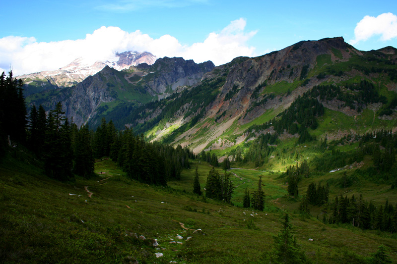
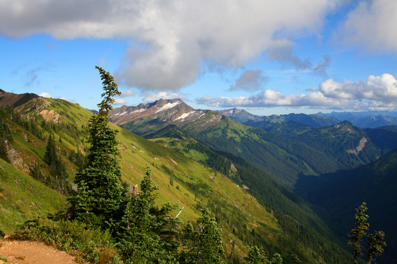
Ascending up towards Red Pass
I let the PCTers speed ahead of me, but I soon crossed them as they were filling up with water and taking a bit of a break. I kept walking, eventually breaking at a beautiful meadow a few miles up the trail. As I was just about to leave, they showed up and were ready for another break, so I sat back down and chatted a bit about our past PCT adventures. We took off together, and we more-or-less walked together to the top of Red Pass. It helped me focus and work to keep pace with them. My knee was doing a bit better for much of the afternoon, but as we began to climb more to the pass and the grade steepened, my knee began to protest once again. Shots of pain radiated from my knee, and on a couple steps, it nearly dropped me to the ground — which it probably would have done if I didn’t have my trekking poles to lean onto. I took a couple more Ibuprofins, but I was soon at the pass and beginning to feel better.
Red Pass
Mt. Sloan and Monte Cristo from Red Pass
Because my knee was a bit of an unknown, and since I had one last large descent, I didn’t spend too much time at the top of Red Pass. I said goodbye to Tasty and Crawfish as they waited for Storybook — she got sidetracked in the meadows picking blueberries and as a result was a little behind the rest of us. The first few steps from the pass were pretty painful, but I soon worked it out and began my descent. I don’t know if it was the buildup of Ibuprofin in my system from a days worth of medication, the evening light that is always a joy to walk in, or the nicely graded descent, but I flew down the switchbacks of that hill. I was racing the setting sun, so perhaps that helped as well.
On the descent from Red Pass. Next stop, the valley bottom — before the sun sets!
I had a great descent. The knee felt good, and I made it to a campsite at 7:30 — just as it was getting pretty dark in the valley and beneath the dense tree cover. I did 18 miles this day, through some rough terrain, on a pretty painful knee, and being pretty out of shape. It felt great.
My last day, since I did the descent the night before, was a super easy 6 mile hikie through beautiful, lush, valley bottom forest. I was originally planning on doing a slightly larger loop for this entire trip, but between my late start on the first day, and my knee, I think this was epic enough. At least for now.